Sage Hartmann · 25 September 2026
Bronzefield Soil Movements Bring Victorian Drainage Systems to Light
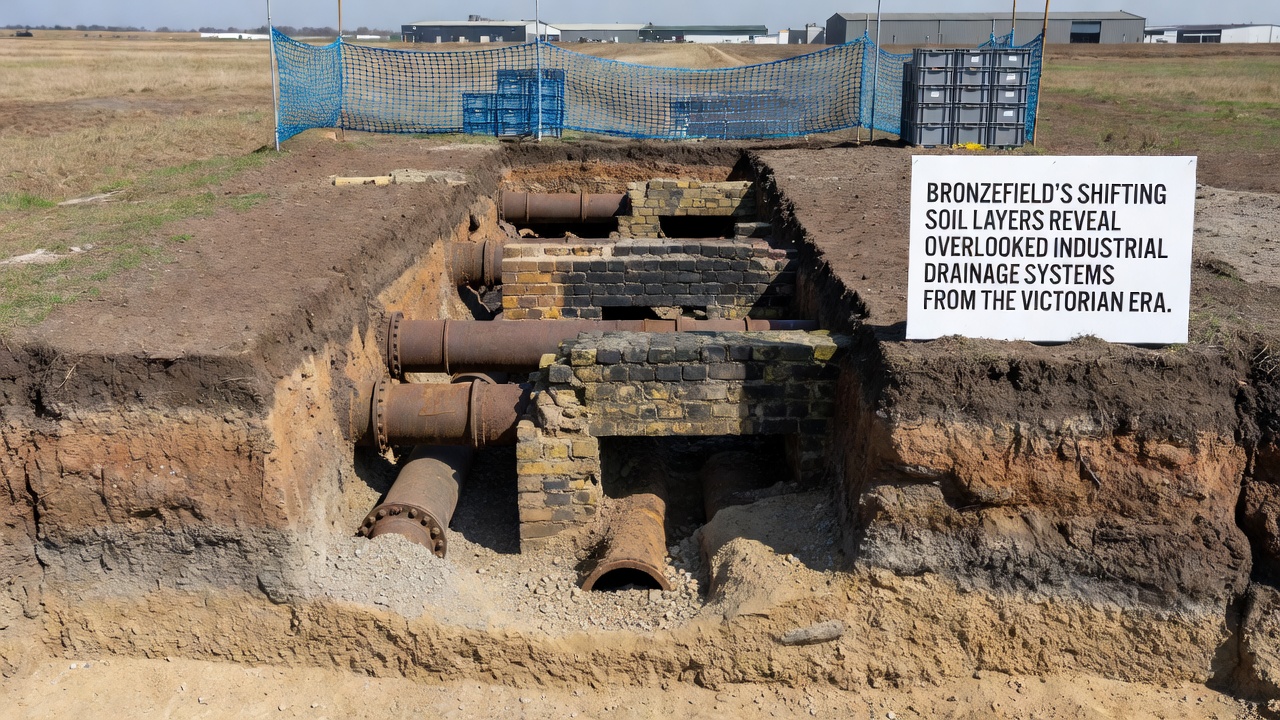
Shifting soil layers across Bronzefield have exposed sections of industrial drainage infrastructure built during the Victorian era, and local surveys continue to document these finds as erosion patterns evolve. The systems, originally installed to manage water flow from factories and housing developments, now appear in areas where ground stability has changed over recent decades. Data from ongoing monitoring programs indicate that natural subsidence combined with seasonal weather variations accelerates the process, bringing brick-lined channels and clay pipes closer to the surface in multiple zones.
Historical Context of the Drainage Networks
Victorian engineers designed these drainage networks to handle increased runoff from expanding industrial sites and residential areas during the late 1800s, and records from that period show extensive use of local clay and brick materials. Workers laid the pipes and channels to direct wastewater and stormwater away from populated districts toward nearby waterways, yet many of these routes were later covered during subsequent urban development phases. Researchers examining parish documents and engineering logs have traced the original layouts to specific factory clusters and worker housing blocks that operated between 1850 and 1900.
Soil composition in Bronzefield includes layers of alluvial deposits and glacial till that respond differently to moisture changes, which creates gradual movement over time. When heavy rainfall saturates upper layers or prolonged dry spells cause contraction, the ground shifts enough to reveal fragments of the older infrastructure. Studies conducted by regional geological teams show that these movements occur at rates varying from a few millimeters to several centimeters annually depending on the exact location and underlying bedrock.
Recent Observations and Mapping Efforts
Monitoring stations installed across the area have recorded notable exposures during 2025 and into September 2026, when additional sections of pipework became visible after a series of wet spring months followed by summer drying. Teams from the local heritage office collaborated with university geographers to map the newly uncovered segments using ground-penetrating radar and drone surveys, and the resulting data sets confirm connections to known Victorian-era outfalls. One mapped channel stretches approximately 180 meters before joining a larger brick culvert that still carries water during peak flow periods.
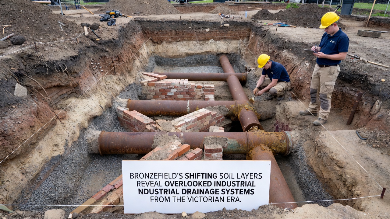
Analysis of recovered pipe fragments reveals manufacturing marks consistent with regional brickworks active in the 1870s, while sediment samples inside the channels contain industrial residues typical of textile and metal processing activities from that time. These findings align with patterns documented in similar sites elsewhere, such as those studied by the United States Geological Survey in comparable sedimentary basins. Observers note that the exposed sections provide direct evidence of how Victorian planners integrated drainage with the natural topography rather than imposing straight-line routes.
Environmental and Heritage Implications
Local environmental records indicate that the drainage systems continue to influence current water movement even where they remain buried, and this interaction affects both flood risk assessments and soil contamination studies. When sections become exposed, authorities assess them for structural integrity before deciding whether to preserve, reroute, or document and re-cover the features. The British Geological Survey maintains an online database of such historical infrastructure that researchers cross-reference during field visits, which helps place Bronzefield examples within broader national patterns of Victorian engineering.
Additional monitoring in September 2026 is scheduled to track further shifts following expected autumn rainfall, and preliminary models suggest at least two more channel segments may surface near former mill sites. Conservation guidelines from regional planning bodies recommend non-invasive recording methods first, followed by selective excavation only where public safety or research value justifies the work. These approaches allow continued documentation without disrupting ongoing land uses in the area.
Future Monitoring and Documentation Plans
Project coordinators have proposed expanding sensor networks to capture real-time soil moisture and movement data across a wider portion of Bronzefield, and this information will feed into updated hydrological models. Partnerships with academic institutions in Canada and Australia have been discussed to compare drainage exposure patterns under different climatic regimes, which could refine predictive tools for similar sites. Public records of the findings remain available through the local council archives, where interested parties can review maps and sediment analysis reports.
Conclusion
The ongoing revelation of Victorian drainage infrastructure through natural soil processes continues to add detail to Bronzefield's industrial history, and systematic recording ensures these elements contribute to broader understanding of 19th-century water management practices. As monitoring extends into late 2026 and beyond, additional data will clarify how environmental factors interact with historical engineering, while preservation decisions balance research needs with practical land management requirements.